Subscribe!

The Capital Center Plan, part 1 – David Brussat
by David Brussat, Architecture Here and There, contributing writer
Photo: Artist rendering of Capital Center initial conceptual design, circa 1980, by Skidmore, Owings and Merrill
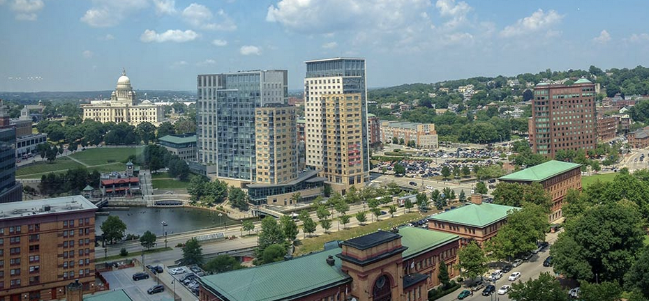
Here this series of chapters from Lost Providence skips back to Chapter 18, “Capital Center Plan” to describe the origins of the plan, announced in 1978, to revitalize downtown by providing a new business district to rival the old downtown. Officials hoped it would lead to some of the new architecture that failed to emerge from the Downtown Providence 1970 plan (announced in 1961). A future chapter, “The Capital Center Build-Out,” is devoted to buildings of the Capital Center plan.
***
Even if the “Interface: Providence” plan disappeared down the rabbit hole too quickly, its legacy was stellar. Still, the legacy required another decade to gestate. Meanwhile, the next major downtown plan was announced in the late 1970s. This was the Capital Center Plan. Amtrak, the national passenger rail system that emerged from the decline and insolvency of the Penn Central (Pennsy) Railroad Company, had decided to renovate the train stations along its Northeast Corridor lines. City and state officials working with Rhode Island’s congressional delegation persuaded Amtrak to redefine “renovation” in this case as moving the tracks and rebuilding the Providence station at the foot of Smith Hill, across Gaspee Street from State House Park. The time had arrived to get rid of the Chinese Wall.


It is fun and maybe even edifying to compare the machinations that resulted in filling the old Cove Casin full of railroad trackage in the 1890s with the Rube Goldberg device of city, state, federal, corporate and institutional relationships that led, almost a century later, to the tracks’ eviction from the gulch in which the Capital Center was built. A small group of unelected bureaucrats, consultants and businessmen maneuvered, waited and maneuvered some more until the moment was right to persuade elected officials, such as Rhode Island Senator Claiborne Pell – a notorious train buff – to sign off on an expenditure of $170 million ($165 million of which came from federal highway and rail agencies) that did an immense amount of good for the citizens of Providence, of Rhode island and, indeed, of New England and the nation as a whole.
This – not just slipping a ballot into a box – is democracy. Behind the scenes, movers and shakers did what was good for themselves and, perhaps, for voters. It might be argued that the same could be said of the different set of movers and shakers in the 1890s. Perhaps three hundred trains a day through Providence at the height of its industrial ambition was a small price for a prosperity strong enough to carry the city through almost a century of economic decline. Perhaps this smacks too much of Voltaire’s “All is for the best in the best of all possible worlds,” from his satirical novel Candide on the over-optimism of philosophers. Simply put, it is sometimes difficult to identify the line between the interests and the voters. Suffice it to say, as Francis Leazes and Mark Motte emphatically do in Providence: The Renaissance City, that moving the railroad tracks was crucial to revitalizing the city in the late twentieth century.
So, having buried the tracks, what could be more natural than to fill the void with a new suburban-style office and residential district? By 1979, the “modernization” of downtown and of College Hill had long since ground to a halt. so why not try again?! Lock and load!

Skidmore, Owings & Merrill, the nation’s pre-eminent architectural firm (modernism’s answer to the Gilded Age starchitects McKim, Mead & White), was hired to produce a master plan for Capital Center. Under the plan, land largely given over to railroad tracks and crumbled asphalt parking lots would be filled with low-rise modernist office blocks. Major retail was to be excluded so as to avoid stepping on the toes of Westminster Street. A centrally located pool forming a diamond was the plan’s only acknowledgement of the city’s rivers. The decking on the world’s widest bridge was left untouched.
A Capital Center Commission was formed in 1979, and a Design Review Committee was assigned to create guidelines for the new district. Those guidelines erected principles by which the regulation of building heights, setbacks, view corridors, signage and a full range of other matters could proceed. But it also included the following fateful declaration:
Beyond these principles, however, the Plan is reticent about mandates to architectural expression. Because it may take more than 20 years to develop the 60 acres, it seems inappropriate to dictate taste or preordain conformity over that much territory and that much time. The Plan grows out of a conviction that in the evolution of cities, design is not only a mirror of the present but an intricate and evolving reflection of all that the city has been.
Almost forty years later, the result confirms the adage that a camel is a horse designed by a committee. The architectural development of Capital Center passed through three awkward phases that might be loosely described as postmodernist, traditional and modernist. This development will be more specifically described in chapter 20. “[A] high value was placed” by the Capital Center Commission’s design panel, supposedly, “on sensitivity to the historic context of the district,” wrote Leazes and Motte. The historic context consisted of downtown, College Hill and the State House. Authorities of that era could be relied upon to genuflect before the god of context before sacrificing it.
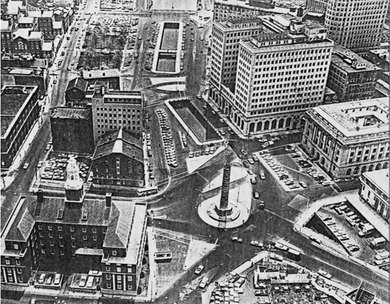
But before the commission had the time to fail spectacularly in expressing its limp contextual sensitivity, another challenge arose. In addition to relocating the railroad tracks, the project envisioned adding a new highway interchange for traffic to exit from Route 95 into the planned new section of downtown. The interchange was to funnel traffic onto a broad avenue, with a meridian, called Memorial Boulevard. In the initial plan, the boulevard was to travel five hundred yards to Memorial Square, an intersection where seven roads met atop the decking near the confluence of the Woonasquatucket and Moshassuck Rivers at the head of the Providence River.
Memorial Square was originally called Post Office Square, after the building under which the two rivers met to form the third, all running through granite channels built long before. By 1979, Memorial Square was known as “Suicide Circle.” Vehicles hurtled from those seven roads into a roundabout encircling a columnar World War I monument, designed by Paul Philippe Cret and completed in 1929. For five decades, vehicles and pedestrians hazarded this convoluted crossing. The new Route 95 interchange would multiply the traffic entering Suicide Circle. A series of ideas from various official and unofficial quarters to deal with this impending chaos included a city proposal to finish covering up the rivers.
In the lore of the Providence renaissance, a napkin looms large.
***
The conclusion of Chapter 18, “Capital Center Plan,” coming up on this blog soon, will describe the napkin that looms large. And how the problem of dumping traffic from I-95’s new exit onto Memorial Boulevard and into Suicide Circle was solved.
___
To read other articles by David Brussat: https://2×8.ea2.myftpupload.com/david-brussat-contributing-writer/

My freelance writing and editing on architecture and others addresses issues of design and culture locally and globally. I am a member of the board of the New England chapter of the Institute of Classical Architecture & Art, which bestowed an Arthur Ross Award on me in 2002. I work from Providence, R.I., where I live with my wife Victoria, my son Billy and our cat, Gato. If you would like to employ my writing and editing to improve your work, please email me at my consultancy, [email protected], or call (401) 351-0451