Search Posts
Recent Posts
- Healthy Lawns with Dr. Jim – a video series from Seascape Lawn Care May 24, 2025
- Burn with Kearns: Obesity, trauma, and movement must be addressed together – Kevin Kearns May 24, 2025
- Rhode Island Weekend Weather for May 24/25, 2025 – Jack Donnelly May 24, 2025
- A Flag Policy for Providence City Hall set by Mayor Smiley, who speaks on Antisemitism, DC murders May 24, 2025
- In the News… quick recap of the week ending May 24, 2025 May 24, 2025
Categories
Subscribe!
Thanks for subscribing! Please check your email for further instructions.

Post-earthquake Bridge Inspection looks good
RITBA inspected its four major bridges following Sunday’s earthquake – inspections show no damage
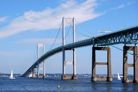
Immediately following the report of an earthquake that rumbled through parts of Southeastern Massachusetts and Rhode Island on Sunday morning, the Rhode Island Turnpike and Bridge Authority (RITBA) consulted with its bridge engineers and dispatched RITBA engineering and maintenance personnel to assess and inspect the Newport Pell, Mount Hope, Sakonnet River and Jamestown Verrazzano Bridges.
As part of the assessment, particular attention was given to the alignment of the joints on the bridges. Utilizing protocols developed specifically for post-earthquake inspections, RITBA found no issues with any of its four major bridges. “The safety of these bridges and their structural integrity is RITBA’s top priority. We are pleased to report that our initial inspections have revealed no issues with any of our four major bridges,” said Lori Caron Silveira, RITBA’s Executive Director. As part of RITBA’s 10-year capital improvement plan, a comprehensive inspection of the four major bridges occurs regularly and is an ongoing process.
The biennial inspection of the Mount Hope Bridge is currently in process. This weekend’s seismic event will prompt the development of enhanced inspection procedures to ensure that the most vulnerable areas of RITBA’s bridges are monitored for any post-tremor issues.
According to the Martha’s Vineyard Times: “People have been experiencing earthquakes in New England since at least colonial times.
“Moderately damaging earthquakes strike somewhere in the region every few decades, and smaller earthquakes are felt roughly twice a year,” according to USGS. “The Boston area was damaged three times within 28 years in the middle 1700’s, and New York City was damaged in 1737 and 1884.
“The largest known New England earthquakes occurred in 1638 (magnitude 6.5) in Vermont or New Hampshire, and in 1755 (magnitude 5.8) offshore from Cape Ann northeast of Boston. The Cape Ann earthquake caused severe damage to the Boston waterfront. The most recent New England earthquake to cause moderate damage occurred in 1940 (magnitude 5.6) in central New Hampshire.”

