Search Posts
Recent Posts
- GriefSpeak: Waiting for Dad – Mari Nardolillo Dias June 13, 2025
- Rhode Island Weather for June 13, 2025 – Jack Donnelly June 13, 2025
- Urgent call by Rhode Island Blood Center for Type O- and B- blood June 13, 2025
- Real Estate in RI: Ready, Set, Own. Pathway to Homeownership workshop June 13, 2025
- Outdoors in RI – Risky cattails, Fight the Bite mosquito report, 2A gun ban bill update June 13, 2025
Categories
Subscribe!
Thanks for subscribing! Please check your email for further instructions.
UPDATED: Hope Street tested as a biker’s Urban Trail
UPDATED: 8-2-2022 (this is a developing story)
As plans come closer to an October “test” of turning a good portion of Hope Street into shared bike lanes, eliminating parking, increasing congestion on a dangerously already-slim roadway, and causing businesses are stepping forward to express concern about the ability of their customers to reach their stores.
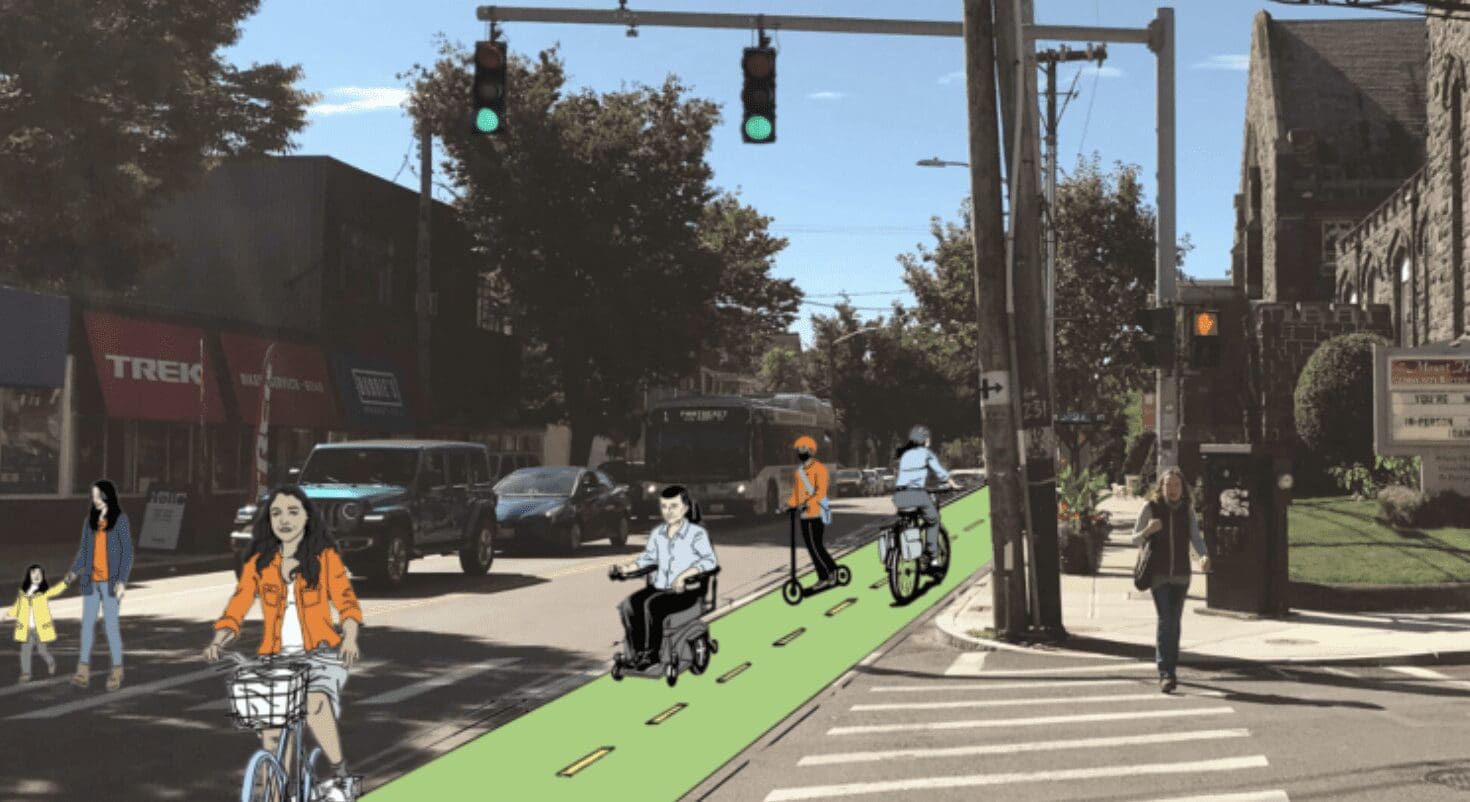
The plan is described by PVD Streets as: “The Hope Street Temporary Trail is a community-led effort that will consolidate parking to the west side of Hope Street and create a one-mile trail for walking, jogging, rolling, and biking on the east side from Lauriston Street to Olney Street (Frog & Toad to Tortilla Flats). The temporary trail will be in place for one week*, and give residents and business owners a chance to experience this potential change in 3D, interact with it, and give their informed feedback.”
Community business response:
In response to our request for opinions on the project and see it as representative of the feelings of several merchants:
“I believe the majority of Hope Street merchants and neighbors are not in favor of the proposal to add an “urban trail” to Hope Street and view the plan as misguided.
We would like to preserve Hope Street, it’s independently-owned businesses, and quiet, residential side streets. We feel this “urban trail” proposal, while attractive in computer renderings and daydreams, is incompatible with our neighborhood. Hope Street is a busy, commercial strip that depends on a constant influx of shoppers from around the state, those visitors need parking, and neighbors would prefer to keep the side streets relatively quiet and safe for children. We are small businesses, micro-businesses with small margins that don’t have the capacity to deal with impediments to our survival.
As a commercial district, we need to accommodate myriad delivery trucks, of every size, all day, every day, as well as city and school buses. Only so much activity can be sustained by a small, densely populated area. The notion that a parking lane, can accommodate the two-way traffic of cyclists, scooters, pedestrians, handicapped and more is a fantasy. We believe the loss of parking, despite the studies that may say otherwise, would be devastating to our small businesses.
There are already dedicated – and rarely used – bike lanes parallel to Hope Street on Blackstone Blvd., and nearby Elmgrove Avenue is much wider and a more compatible host to a bike lane. What we would like from the city is basic maintenance — sidewalk repairs, street cleaning, timely trash removal and effective snow plowing, and until those goals are met, it seems madness to layer complex infrastructure on top of things.
The Urban Trail would also narrow the lanes dedicated to driving. Lanes which currently barely support the volume of trucks and buses we support. Despite talk of Loading Zones, a narrower street will cause congestion and safety concerns as delivery trucks will have to double park and buses will no longer be pulling over, but stopping mid-driving lane. This chaos would take place in a densely populated area, where houses and driveways on Hope Street are close together, again, incompatible with an urban trail as residents would have to constantly back in and out across the bike lane. We’re also concerned that the loss of parking by Lippitt Park for the Farmer’s Market vendor trucks would be difficult for this market that the neighborhood loves and wants to continue to thrive. Luckily, I live on a side street, but would find backing out of my driveway through bike+ lane terrifying and I would imagine that would be even more so to the numerous elderly folks in the neighborhood.
As both a merchant and resident of the Hope Street/Summit neighborhood, I was not reached out to in any way during the planning of this proposal or the upcoming trial until very recently, and that outreach happened nor was a single neighbor or merchant I’ve spoken with, and those are many. Outreach occurred after complaints were made. Additionally, we feel that any data collected that would influence this proposal be designed and collected by a neutral third party to insure transparency and fairness. We feel that the current data was cherry-picked and guided by the way questions were asked by the well-funded, single issue, Providence Streets Coalition.”
Sincerely – Kim T. Clark – www.RHODYCRAFT.com – 769 Hope Street, Providence, 02906

We received community newsletters and copies of emails from residents, but were asked not to use them publicly.
___
Around the US: Projects have exploded in the US to add bike lanes to existing roads, regardless of the width of those roads. The Washington Post noted that “City officials across the U.S. are installing hundreds of miles of bike lanes as they respond to a cycling boom that began during the pandemic and capitalize on federal grants, including from the roughly $1 trillion infrastructure law.” Total dollars available around the US might approach $7 trillion says the Adventure Cycling Association, which is assembling what it calls the U.S. Bicycle Route System.
The article notes that these routes can be “counterintuitive, unsafe and just plain pointless” – especially as cities come back to life after the pandemic.
In Baltimore, part of a bike lane was removed shortly after installation to restore parking spaces for a church and now the the bike lane goes for about one block, with cyclists being diverted onto the sidewalk.
Los Angeles, which posts some of the country’s longest car-commuting times, has dialed back some of its cycling development over worries about impeding traffic. In 2015, L.A. approved a master plan for a network of bikeways and has since carried out about 3% of it, with completion estimated to be 2248.
Cities around the country are retrofitting bike lanes into some of the narrowest and most congested roadways, and cyclists often complain about a patchwork of short, unconnected bike lanes.
___
Around the US:
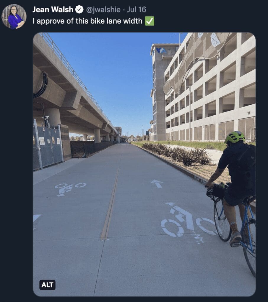
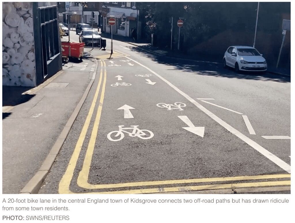
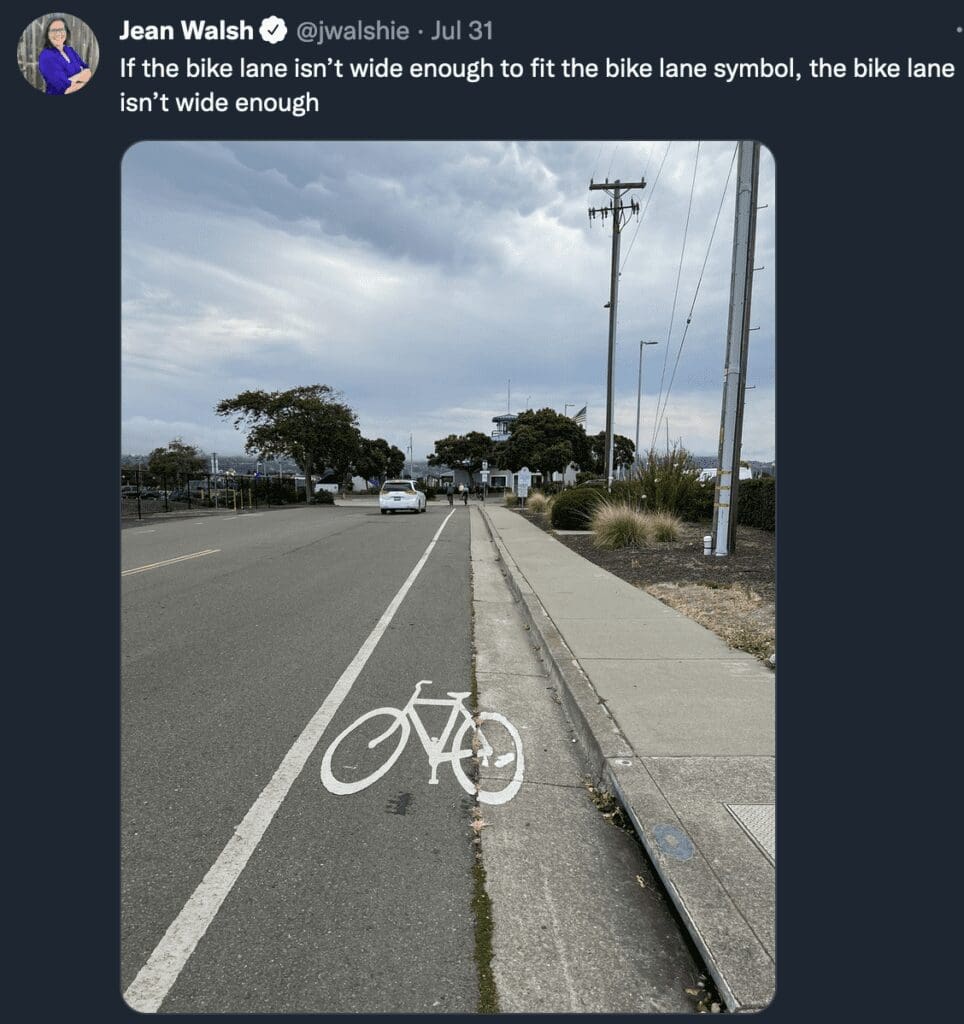
To those who’ve been on Hope Street recently, there is activity that led us to ask about a 3-year old or older proposal to put bike, walking, “rolling” lanes on a safety-challenged narrow Hope Street on the East Side of Providence. Lined on both sides with shops, and restaurants, one is always extra cautious when parking, or walking and crossing the street. Lines of vision are less than desirable, and frequent users know to use extra caution. Some we spoke with said they long gave up going to Hope Street in prime time for lunch or the stores due to traffic, congestion, safety, and lack of parking.
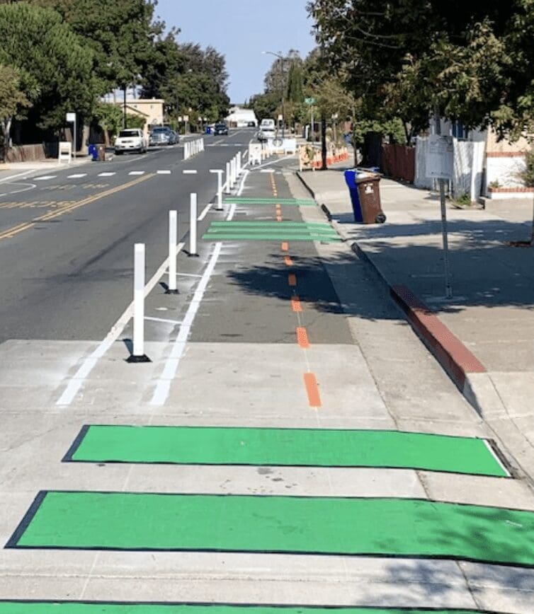
This photo shows a typical “Urban Trail” – but has no solution for how the 2 garbage cans would get picked up, blocked as they are by the lanes and the divider poles.
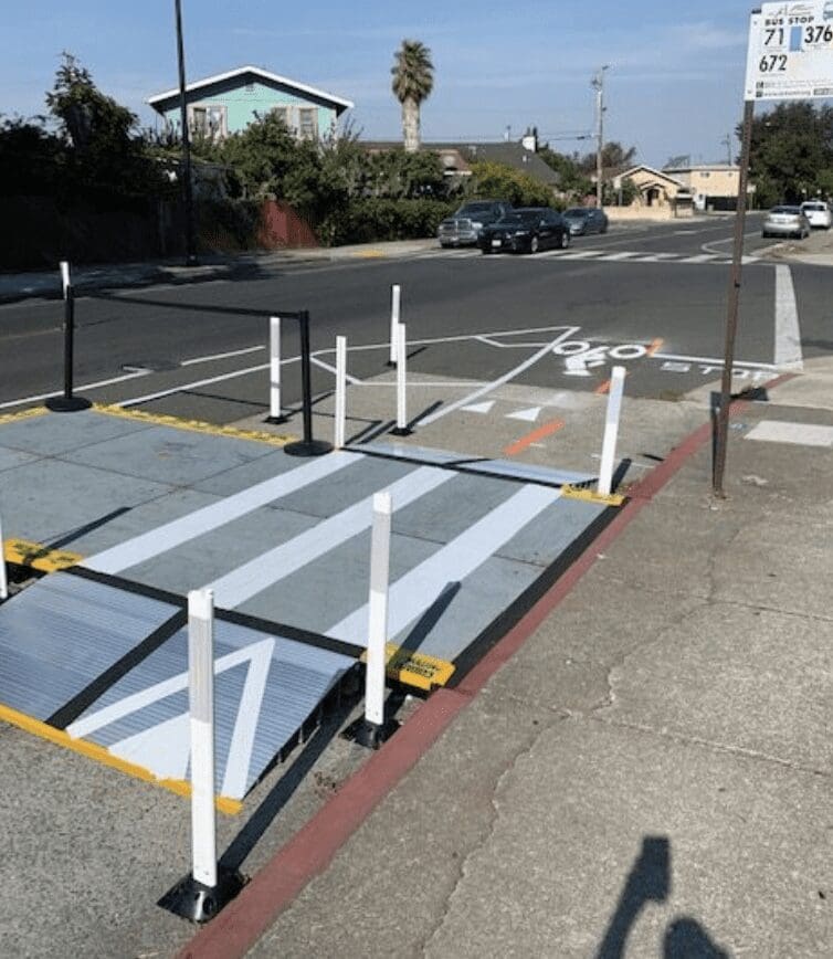
Bus-loading platforms – platforms are built into the roadway and over the bike path for pedestrian use to board buses. There is no provision or discussion about delivery vehicles servicing local businesses or residences – or street sweeping – or emergency vehicle considerations.
___
Here is the presentation that was made to the East Side community:
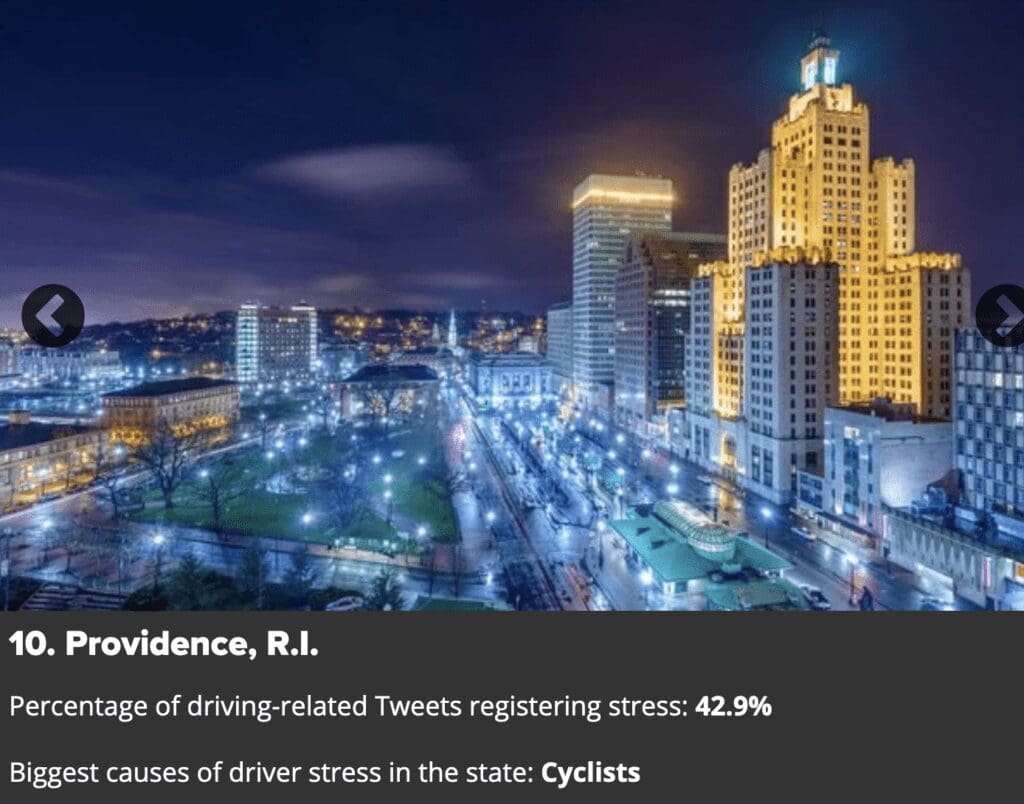
A survey by NU Realty Services of which cities are the most stresssful to drive in, and what is the cause of that stress. Providence came in as #10 and the cause of stress? Cyclists.
East Bay Bike Path
Last week the police had to move bikers off the East Bay Bike Path at night. The path closes for use at sundown. The biking group has now appealed that the entire 13-mile bike path be open 24/7.
___
The Providence Streets Coalition and the city of Providence plan to test the temporary “urban trail” on Hope Street this fall. Part of the city’s start-and-stop “Great Streets Plan, the study as well as the entire project notes the partnership with Thriving Places Collaborative, SPIN Streets, AARP , and 3M Gives, as well as “local partners, residents, and businesses.
This temporary urban trail test on Hope Street in Providence is part of a much larger City of Providence’s Great Streets Plan. This plan is responsible for all the lanes appearing in the city, particularly downtown, and often leaving driving lanes edged out of room.
The plan is to consolidate parking to the west side of Hope Street and create a one-mile trail for “walking, jogging, rolling, and biking” on the east side from Lauriston Street to Olney Street (Frog & Toad to Tortilla Flats).
The temporary trail will be in place for one week to and give residents and business owners a chance to experience “this potential change in 3D, interact with it, and give their informed feedback”.
In an informal check with some local businesses who already deal with compromised parking and a dangerous road at peak times, we learned most businesses had not heard that this “trial” time was moving forward.
During the week, the group says it will “assess safety, parking and business impacts, and collect community feedback” data that will help plan future street interventions for “safer, more sustainable, and more inclusive mobility”.
Timeline:
- Fall 2021: Public meeting held with Councilwoman LaFortune
- Fall 2021: Community surveys and parking study collected
- Fall 2021-Summer 2022: Business and resident direct engagement
- Winter/Spring 2022: Funding applications
- Spring 2022-Summer 2022: Physical planning: engineering drawings, logistics, procurement, volunteer recruitment
- October 2022: Installation
- December 2022: Final report and community meetings
At this time, the group notes that Providence has no funding or timeline to implement a permanent trail or other street design changes. Click here for an example of a temporary trail on Broad Street.
Parking data presented about Hope Street
- From Hope Street from Olney to 4th Street and one block to the east and west
- 30 volunteers collected occupancy on a Saturday, Sunday, Monday, and Tuesday Counted 4x / day, each block counted 16 times
- 132 Parking Spaces are located on the east side of Hope Street, which represents 9% of total parking spaces in the area
- The average occupancy rate is 24%, meaning 76% of parking spaces are open for parking
- The highest occupancy rate at the busiest time (Saturday afternoon) is 35%, and there are 452 vacant spaces
- In the northern section of Hope Street, there is an occupancy rate of 46%, with 322 vacant spaces
- The lowest occupancy rate at the least busy time (Monday afternoon) is 15%, with 1164 vacant spaces
During the Hope Street Urban Trail temporary demonstration project, 132 parking spaces will be repurposed for the trail, which represents 9% of the total parking spaces available in the study area. We anticipate that 1318 parking spaces will remain available. A few of these spaces may be converted into loading zones for the businesses in the area, additional accessible (handicapped) spaces, and buffer zones to allow for safe passage from the west to east side of Hope Street.
The highest occupancy rate in the parking study area occurred on Saturday afternoon, when 34.88% of spaces were occupied. This high occupancy rate was concentrated primarily in the business district in the north, particularly around Rochambeau Avenue. During the busiest time, there are 844 vacant spaces, particularly on the side streets directly adjacent to Hope Street. 322 of these spaces are in the northern section of the area, next to the business district.
The lowest occupancy rate in the parking study area occurred on Monday midday, when 15.02% of spaces were occupied. During the least busy time, there are 1233 vacant spaces in the area.
The highest occupancy rates in the north section (i.e. business district) of the parking study area occurred on Saturday afternoon and Saturday night, when 45.48% and 35.34% of spaces were occupied. However, even during these busiest times, ample parking is available on the side streets in the area. On Saturday afternoon, there were 386 vacant spaces available in this section and on Saturday night, there were 558 vacant spaces.
The highest occupancy rates in the south section (i.e. residential district) of the parking study area occurred on Monday morning and Sunday midday, when 26.02% and 24.03% of spaces were occupied. We are aware that Sunday midday is a time when many churches in the area have services, and we will be working with them to assure that parking is as accessible as possible during that time. On Monday morning, there were 435 vacant spaces available in this section and on Sunday midday, there were 443 vacant spaces.
Community Survey: Summary of Findings
- An online survey, November-December, 2021 and received 496 responses
- 55.4% of respondents either live on Hope Street or within 2 blocks, another 25.4% live within a quarter mile.
- 16 business owners responded, 10 do not support a permanent trail
- 63.8% of respondents expressed support for an urban trail on Hope St.
- 63.5% of respondents say they would be more likely to ride on Hope St. with a safer trail
- 48.9% of respondents who currently ride a bike on Hope St. have safety concerns
- Top concerns: parking; safety for drivers, cyclists, pedestrians; impacts on business
Next Steps:
- July & August:
- Full canvass #1
- Design and deliver business survey
- Install counter to start collecting user data
- Community meetings and BBQs: Friends of Rochambeau, YMCA, Mount Hope Community Center, faith institutions, school PTOs
- Order materials
- September:
- Full canvass #2 right before installation
- Event planning – movie night, Bike & Walk to School Day, Providence Bike Jam
- Volunteer coordination
- Installation plan
- October: install!
- Data collection:
- In-business surveys
- Intercept feedback
- Trail user surveys
- Counters
- Data collection:
- November & December:
- Post-installation community survey
- Data analysis
- Report writing
- Final community meetings
CONTACT: Liza Burkin, Lead Organizer, Providence Streets Coalition. liza@ourstreetspvd.org, 401-400-1382
___
Partners in this initiative:
Partners and supporters of Providence Streets Coalition are listed:
- American Heart Association – Health Benefits of Complete Streets
- People for Bikes – Statistics Library on Benefits of Bicycling
- Rhode Island Bicycle Coalition – RI Bike Laws
- AARP – Planning Complete Streets for an Aging America
- AAA Northeast – AAA on the Issues, 2017
- Stockholm Environment Institute and Brown University Climate and Development Lab – Deeper Decarbonization in the Ocean State: The 2019 Rhode Island Greenhouse Gas Reduction Study
- Executive Climate Change Coordinating Council (EC4) – Resilient Rhody: An Actionable Vision for Addressing the Impacts of Climate Change in Rhode Island
___
RINewsToday has been following stories on the Great Streets Plan for the past several years. NBC10 did a story on the Hope Street bike plan which left morning anchors saying how tight the street already is – the story was accompanied by a video of several shop orders already noting the tight parking – and one showed a video of bikers doing wheelies going down a Providence bike lane.
Here is our story from the fall of 2021 of bike lane installation in downtown Providence’s South Main Street:
And, our story on downtown Providence projects, also designed to “calm traffic”:
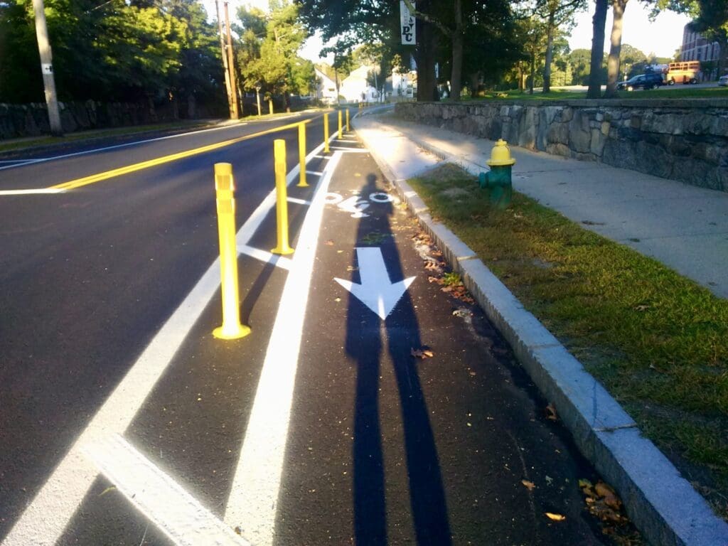
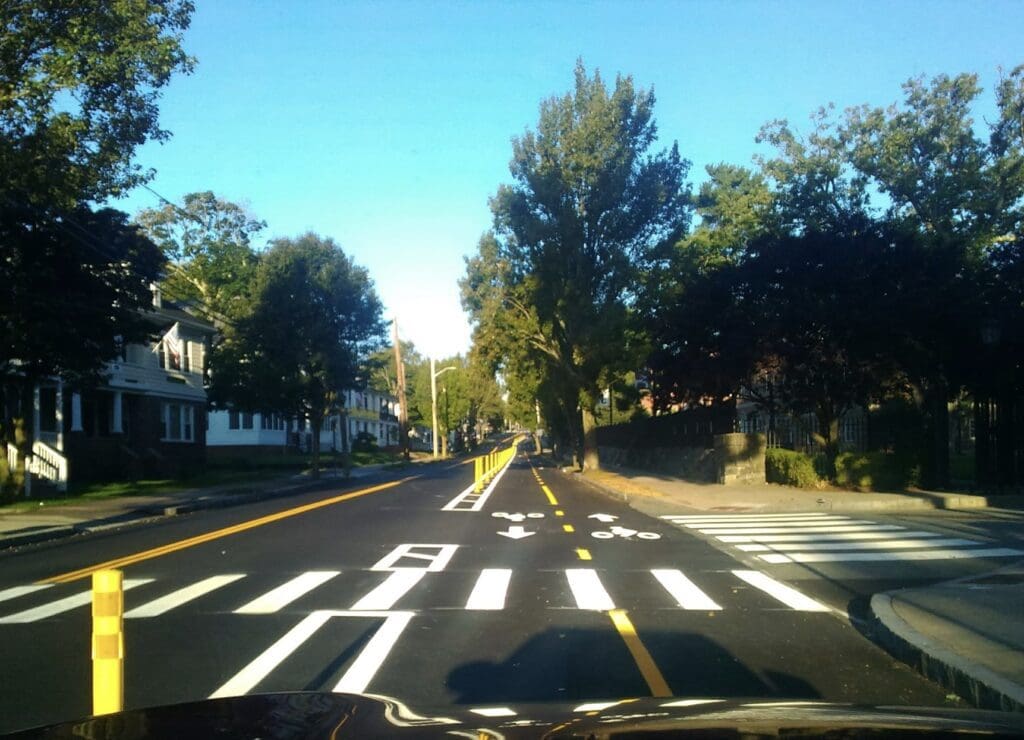
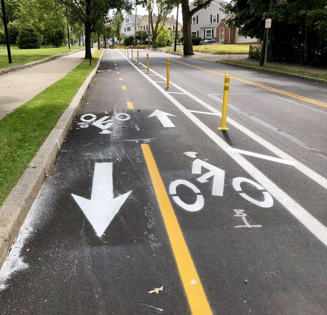
RINewsToday also followed the story of a bike lane installed on Eaton Street, adjacent to Providence College. The project cost approximately $100,000 to install and less than 2 months later, it was completely removed for another $100,000. Photos taken for RINewsToday.
When asked for any updates on the project, Providence Mayor Elorza responded with this: “This will be a temporary demonstration managed by the Providence Streets Coalition. Please reach out to Liza Burkin at liza@ourstreetspvd.org.”
This is a developing story
