Subscribe!

RI Weekend Weather Wrap: Sat/Sun, Jan 4 & 5, 2020
By Jack Donnelly, meteorologist
Saturday 1/4/20:
A low pressure system passing to our south will generate basically all day light rain and wind for the first half of the weekend. Continued warmer than normal temperatures with an early low around 40 and afternoon highs in the upper 40’s accompany the rain. Winds will eventually be shifting from easterly to northwesterly, dropping dewpoints and helping to dry things out in the lower levels, thinning the extensive cloud cover.
Sunday 1/5/20:
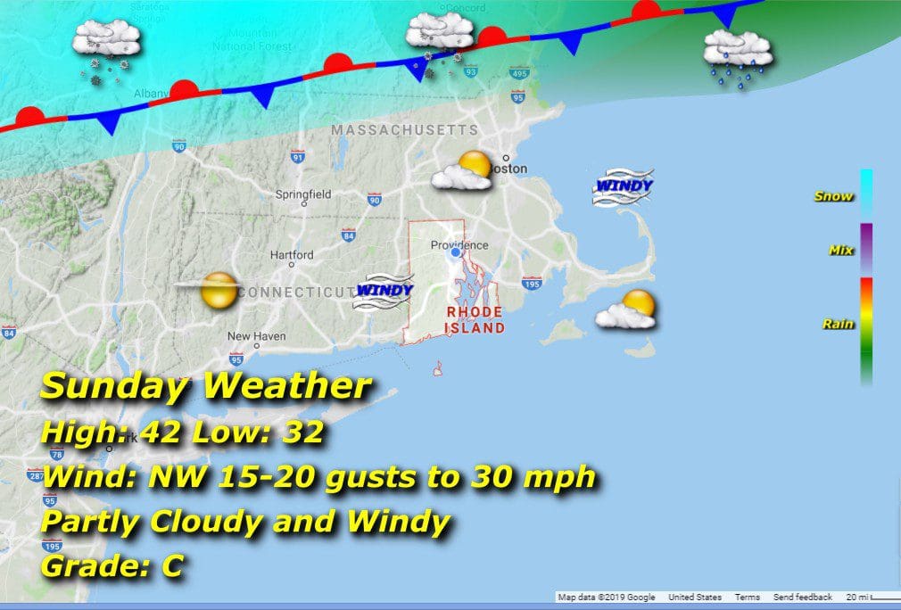
Low pressure heads east with high pressure building to the west, so expect winds building from the resulting pressure gradient through the day and gusts approaching 30 mph. The Sun will be emerging, with a secondary frontal boundary developing to the north, along which will build some light snow in the central New England highlands. This should not be an issue here given the stationary nature of the front. Temps will be still slightly above the normal range, lows around freezing and highs in the low 40’s to close out 2020’s first weekend.